QGIS Level I & II – Online
- Start Date: January 01, 2024
- End Date: December 31, 2024
- Time: You choose the time and the dates!
- Venue: online via Zoom
- Instructor: Richard Johnson
- Online dates arranged by you and the instructor. Dates listed on the webpage are arbitrary but must be selected due to the webpage template. The course can be taught any time that works for you and the instructor.
Course Description
The QGIS mapping program has become the go-to software for people that want to map and analyze geospatial data using a free, open source product. Supported and continuously developed by designers world-wide, the program is replacing ArcGIS in many organizations. The program is easy to download and use but requires a bit of orientation for people that are new to mapping software.
An introductory and second level course is now available on-line from Opus Petroleum Engineering Ltd. In this course the student meets with the instructor in a video-chat environment (Zoom). With screen sharing, they work through the basics, using the program to create topographic maps, add data layers such as roads, cut blocks, mine sites and a vast selection of data from public sources as well as data from their own GPS projects. Satellite image data can easily be added as well as Open Street Map layers. The usual time required for the on-line sessions is 6 hours and these can be scheduled into bite sized pieces scheduled to the convenience of the student.
Our Instructor
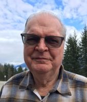 Richard Johnson is a geological engineer who has worked in the petroleum industry for over thirty years prior to moving to the Slocan Valley in 2007. He has over thirty years of experience teaching courses to students, he is one of the founders of the Slocan Wetland Assessment and Monitoring Project (SWAMP) and after 8 years on the board of the Columbia Basin Watershed Network he continues to serve on their science committee who offer an annual mapping program with Selkirk College. Richard continues to perform hydrogeological studies, aquifer mapping, satellite image interpretation, and teach QGIS! He can be reached at richard.slrc@gmail.com
Preparation for the course
Students will work on their own computer and should have QGIS 3.22 version, or later, loaded and functioning. Students are expected to be able to open the program. There is a slight variation between the Windows and the Mac versions but both versions have been functioning perfectly in the class room setting.
The latest version of QGIS can be downloaded from here. Details on how to install and run the program can be found at on the same site.
A data package will be provided to registered students. It will contain all of the example data that we will be working with in the class. Richard will also provide follow-up for one month after the course for individuals who have questions and problems.
If you wish to get a better understand of GIS before you come to this course, you could use these resources here.
Registration
This on-line course is available for $325 plus GST. To register or get more information contact Hailey at office@cmiae.org and note that you are interested in the on-line version of the QGIS Intro course.